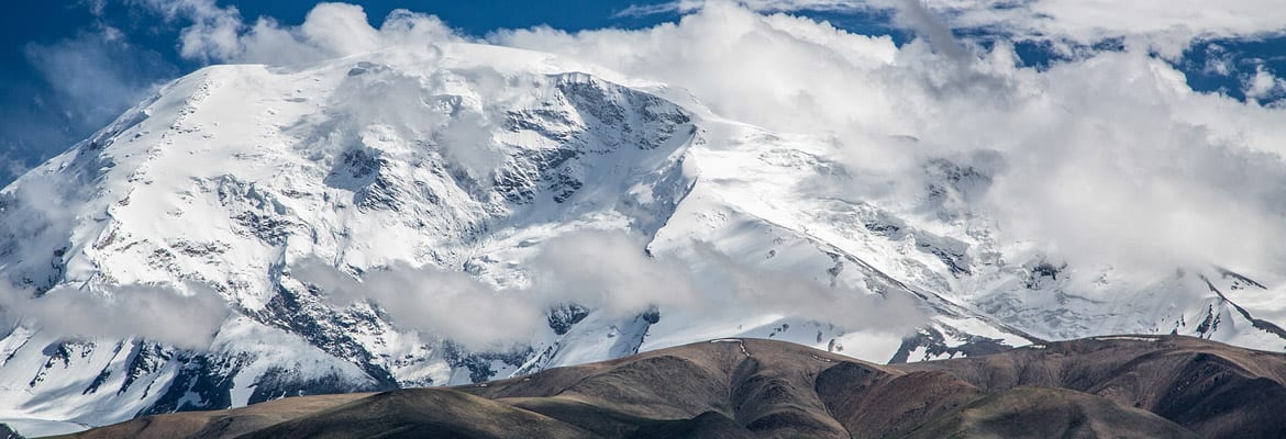
Muztagh Ata Guides: Verified Reviews, Route, Ski Ascent, Season and How to Climb
Muztagh Ata, at 7,546 m (24,757 ft), is one of the most accessible 7,000 m peaks in the world. It stands in the far west of China's Xinjiang region, on the eastern edge of the Pamir, above Karakul Lake and the Karakoram Highway, about four to five hours by road from Kashgar. Its name is usually translated as "father of ice mountains". The standard West Ridge route is a long, broad snow slope with crevasses but no sustained technical climbing, which makes it a popular first 7,000 m peak and one of the best high peaks in the world for a ski ascent and descent. The main season is July and August, and expeditions usually take about three to four weeks from Kashgar. The first ascent was made in 1956 by a joint Chinese and Soviet expedition. On ExpedReview, as of 23 October 2026, one operator has a verified review for Muztagh Ata: Exped Tribe, 5.0★ from 1 review (July 2026). Below is the ranking, followed by a full guide to the climb.
Muztagh Ata: key facts | | | |---|---| | Height | 7,546 m (24,757 ft) | | Location | Xinjiang, western China, eastern Pamir | | Nearest city | Kashgar, about 4–5 hours by road | | Standard route | West Ridge (West Flank) | | Base Camp | About 4,400–4,500 m, above Subash | | High camps | About 5,400 m, 6,100–6,200 m and 6,800 m | | Technical grade | Non-technical snow climb with crevasses | | Best season | July–August | | Typical expedition | About 3–4 weeks | | First ascent | 1956, joint Chinese–Soviet expedition | | Ski descents | Very popular |
Muztagh Ata guides ranked by verified reviews
Rankings use each operator's verified ExpedReview client reviews for Muztagh Ata, with recent reviews weighted more heavily. Every review is checked by hand before it is published. Data as of 23 October 2026.
| Operator | Based in | Rating here | Reviews | Latest review | Price |
|---|---|---|---|---|---|
| Exped Tribe | Switzerland | 5.0★ | 1 | July 2026 | No recent price listed |
The single reviewer climbed Muztagh Ata on skis with Exped Tribe, reported a summit, and said they were "very positively surprised" by the logistics and organisation. With only one review, ask any operator for references from recent seasons.
Why climb Muztagh Ata?
Muztagh Ata is the classic stepping stone from 6,000 m peaks to the 8,000 m giants. It gives climbers experience of the altitudes they will meet on Cho Oyu or Manaslu, with simpler logistics and lower costs, and teaches them how their body responds above 7,000 m. Its long, gentle slopes are perfect for ski mountaineers, and the mountain sits in a dramatic landscape of high desert, glaciers and Kyrgyz herders' camps. For many climbers it is also a gateway to the Silk Road culture of Kashgar. See how to choose your first 8,000 m peak.
Getting there
Most expeditions start in Kashgar, reached by air via Urumqi or other Chinese cities. From Kashgar, the Karakoram Highway climbs past the Gez River gorge to Karakul Lake at about 3,600 m, where many teams spend a night or two to acclimatise. From the road at Subash, camels or donkeys carry the gear to Base Camp at about 4,400–4,500 m, a walk of a few hours. Access to Xinjiang is subject to Chinese government rules that can change at short notice, so rely on an experienced operator for permits, travel documents and transport.
The West Ridge route, camp by camp
| Camp | Approximate altitude | Notes |
|---|---|---|
| Base Camp | 4,400–4,500 m | Grassy moraine, reached on foot with pack animals |
| Camp 1 | About 5,400 m | Up scree and moraine to the glacier edge |
| Camp 2 | About 6,100–6,200 m | Through a crevasse zone on the glacier |
| Camp 3 | About 6,800 m | On the broad upper slopes |
| Summit | 7,546 m | Long snow slopes to a broad summit plateau |
From Base Camp, a steep path over scree and moraine leads to Camp 1 at the edge of the snow. Above, the route climbs a broad glacier slope with crevasses, the main objective hazard, to Camp 2. Teams rope up or travel on skis with care in this section. Camp 3 sits high on the open upper slopes, and from there summit day is a long climb up gentle but relentless slopes, then across a wide plateau to the highest point. Finding the true summit can be difficult in poor visibility, as the plateau is broad and featureless. A round trip from Camp 3 often takes ten to twelve hours.
Most expeditions climb the mountain in rotations, which take time but greatly improve safety and summit chances: they carry loads and sleep at Camps 1 and 2, return to Base Camp to rest, and then make a final push, so climbers acclimatise before the summit.
A typical expedition schedule
Schedules vary, but a common pattern for a three to four-week expedition looks like this. After arriving in Kashgar, the team spends a day sorting gear, buying last supplies and exploring the old town and markets. The drive along the Karakoram Highway to Karakul Lake follows, often with a night by the lake to start acclimatising. The team then walks to Base Camp with camels or donkeys carrying the loads, and spends a couple of days resting and practising skills.
The first rotation usually involves a carry to Camp 1, a night there and a return to Base Camp. The second rotation climbs to Camp 1, then to Camp 2 for one or two nights, perhaps with a walk higher towards Camp 3, before descending to rest. After two or three rest days at Base Camp, the team sets off on the summit push: one night each at Camps 1, 2 and 3, then summit day, then a descent to Base Camp over one or two days. Several spare days allow for storms and for climbers who need more rest. The return to Kashgar takes a day.
Safety
The main hazards on Muztagh Ata are crevasses, especially between Camps 1 and 2; altitude illness, including high-altitude pulmonary and cerebral oedema; frostbite and hypothermia on the cold upper slopes; avalanches after heavy snowfall; and getting lost in whiteouts on the broad summit plateau. Good practice includes roping up or skiing carefully in crevassed areas, marking the route with wands, carrying GPS tracks, turning back at an agreed time on summit day and descending at the first signs of serious altitude illness. Rescue resources are limited, so teams must be self-sufficient. Check that your insurance covers climbing to 7,546 m and evacuation from western China.
Muztagh Ata compared with other 7,000 m peaks
| Peak | Height | Location | Technical difficulty | Notes |
|---|---|---|---|---|
| Muztagh Ata | 7,546 m | Xinjiang, China | Low | Great for skiing; broad slopes |
| Lenin Peak | 7,134 m | Kyrgyzstan–Tajikistan | Low to moderate | Busy; avalanche risk on some sections |
| Baruntse | 7,129 m | Nepal | Moderate | More technical, Himalayan approach |
| Himlung Himal | 7,126 m | Nepal | Low to moderate | Popular 8,000 m preparation peak |
Muztagh Ata is higher than most other popular 7,000 m training peaks, which makes it especially useful preparation for the altitude on an 8,000 m climb. Lenin Peak is lower but has more objective hazards in places, while Nepal's 7,000 m peaks offer a Himalayan experience closer to what climbers meet on the 8,000 m giants.
Kashgar and the Silk Road
Many climbers remember Kashgar as much as the mountain. The city was a key stop on the ancient Silk Road, and its markets, mosques and food reflect centuries of trade between China and Central Asia. Allow a day or two before or after the climb to explore, and follow your operator's advice on local rules, which are strict in Xinjiang.
Cost
Muztagh Ata is far cheaper than an 8,000 m expedition, but costs vary widely with the level of support. Basic packages provide permits, transport, Base Camp services and pack animals, while fully guided expeditions add Western or local guides, stocked high camps, cooks at high camps and sometimes bottled oxygen. Budget separately for international flights, visas, equipment, insurance and tips. Exped Tribe did not list a recent price on ExpedReview at the time of writing, so ask operators for current quotes.
Skiing Muztagh Ata
Muztagh Ata is famous as a ski peak. Many climbers use skis with skins from Camp 1 upwards, and ski back down from as high as the summit, in conditions that range from powder to wind crust. Skiing makes travel across crevassed slopes safer, because weight is spread more widely, and the descent faster and easier on tired legs. If you plan to ski, you should be a confident off-piste skier, able to ski steep, variable snow with a heavy pack, and practised in ski mountaineering and crevasse rescue. Snowshoes are an alternative for those who do not ski, though they make the long upper slopes slower and more tiring, and climbers on foot need to take extra care in crevassed zones.
Best time to climb
The main season is July and August, when the weather is most stable. June and September are possible but colder and less settled. Summer days at Base Camp can be warm and dry, but above Camp 2 temperatures often fall well below −20 °C at night, and strong winds are common on the upper slopes. Storms can bring heavy snowfall, which raises avalanche risk on some slopes.
How hard is Muztagh Ata?
Muztagh Ata is technically easy but physically very hard. The altitude is the real challenge: above 7,000 m, the body cannot acclimatise fully, and every step takes effort. Summit days are long and cold, and some climbers find the broad slopes mentally tiring because the summit seems never to get closer. Most expeditions climb without bottled oxygen, though some operators offer it. See what happens to the body at high altitude and acute mountain sickness.
Experience and skills you need
Climbers should have:
- Experience at 6,000 m or higher, for example on Aconcagua, Lenin Peak or a Himalayan trekking peak.
- Glacier travel and crevasse rescue skills.
- Crampon and ice axe technique.
- For ski ascents, solid off-piste and ski mountaineering skills.
- Fitness for several weeks of hard work at altitude.
See our Aconcagua guide, Aconcagua gear list and Lenin Peak guide.
What to bring
Kit is similar to a lower 8,000 m expedition: double mountaineering boots or ski touring boots rated for high altitude, an expedition down suit or down jacket and trousers, a sleeping bag rated to about −30 °C, warm mitts and gloves, goggles and glacier glasses, a harness, crampons, an ice axe and, if you ski, skis with skins and ski crampons. Operators usually provide tents, cooking equipment and food on the mountain. See how to choose mountaineering boots.
Permits and practicalities
Climbing permits are arranged through the regional mountaineering authorities in Xinjiang, usually by your operator. You need a Chinese visa and, depending on current rules, additional permits for the border region. The currency is the Chinese yuan; many local payments are made through mobile apps, so bring cash and ask your operator for advice. Mandarin and Uyghur are widely spoken in Kashgar, and Kyrgyz near the mountain, so an operator with local staff is essential.
Training
Training should start at least four to six months ahead. Build a strong aerobic base, carry heavy packs on long hill days, strengthen your legs and core and, if you plan to ski, spend time ski touring. Pre-acclimatisation on a 5,000–6,000 m peak before the trip helps. See our mountaineering training guide.
Choosing an operator
Ask operators about their record on Muztagh Ata, the experience of their guides at 7,000 m, guide-to-client ratios, how many camps are stocked, whether they offer bottled oxygen, and how they handle weather days and emergencies in a remote region. Check the cost includes permits, transport from Kashgar, pack animals and food on the mountain. See how to choose a guide.
History
The mountain's name is often linked to the "father of ice mountains" in the local Turkic languages. The Swedish explorer Sven Hedin made attempts in 1894 but did not reach the top. The first ascent came in 1956, by a joint Chinese and Soviet expedition via the West Ridge. Since China opened the area to foreign climbers in the 1980s, Muztagh Ata has become one of the most climbed 7,000 m peaks in the world.
Frequently asked questions
Where is Muztagh Ata?
In the far west of China's Xinjiang region, on the eastern edge of the Pamir, about four to five hours by road from Kashgar.
Is Muztagh Ata technical?
No. The West Ridge is a non-technical snow climb, but crevasses, cold and altitude make it serious.
How high is Muztagh Ata?
7,546 m (24,757 ft).
Is Muztagh Ata a good first 7,000 m peak?
Yes. It is one of the most popular, because the standard route is non-technical, though the altitude makes it very demanding.
Can you ski Muztagh Ata?
Yes. It is one of the most popular high-altitude ski peaks in the world.
When is the best time to climb Muztagh Ata?
July and August.
How long does a Muztagh Ata expedition take?
About three to four weeks from Kashgar.
Do I need bottled oxygen on Muztagh Ata?
Most climbers climb without it, though some operators offer it.
Which operator has reviews for Muztagh Ata on ExpedReview?
Exped Tribe, with 5.0★ from 1 verified review (July 2026), as of 23 October 2026.
Related articles
- How to choose a guide
- Best operators
- Pamir, Kunlun and Mongolia Expedition Guides: Verified Reviews
Expeditions in the Pamir, Kunlun and Mongolia: operators ranked by verified ExpedReview client reviews, plus a guide to Lenin Peak, Muztagh Ata, the Pamir 7,000ers, Khan Tengri and Mongolia's Altai, with seasons, access, permits and how to choose.