Climbing the Seven Volcanic Summits: Facts & Information
After famed mountaineers Dick Bass and Reinhold Messner became the first people to climb their respective versions of the Seven Summits in the late twentieth century, mountaineers worldwide sought a new and exciting challenge.
A decade later, in 1999, the idea began to circulate in mountaineering circles about climbing the Seven Volcanic Summits.
In order to qualify for the title of being the continent’s tallest volcano, the mountain had to have erupted from separate vents and have at least 305 metres (1,000 feet) of prominence.
This new and exciting mountaineering challenge soon gained traction and remains a popular objective within the climbing community.
Similar to the Seven Summits and Seven Second Summits, the Seven Volcanic Summits boast a mix of both relatively easy destinations and incredibly challenging ones. Also, like the mountaineering objectives mentioned above, this challenge takes climbers all over the world.
Seven Volcanic Summits at a Glance
| Peak | Elevation | Country | Continent |
|---|---|---|---|
| Ojos del Salado | 6,893 m (22,615 ft) | Argentina & Chile | South America |
| Kilimanjaro | 5,895 m (19,341 ft) | Tanzania | Africa |
| Elbrus | 5,642 m (18,510 ft) | Russia | Europe |
| Pico de Orizaba | 5,636 m (18,491 ft) | Mexico | North America |
| Damavand | 5,610 m (18,406 ft) | Iran | Asia |
| Mount Giluwe | 4,368 m (14,331 ft) | Papua New Guinea | Oceania |
| Mount Sidley | 4,285 m (14,058 ft) | – | Antarctica |
1| Ojos del Salado
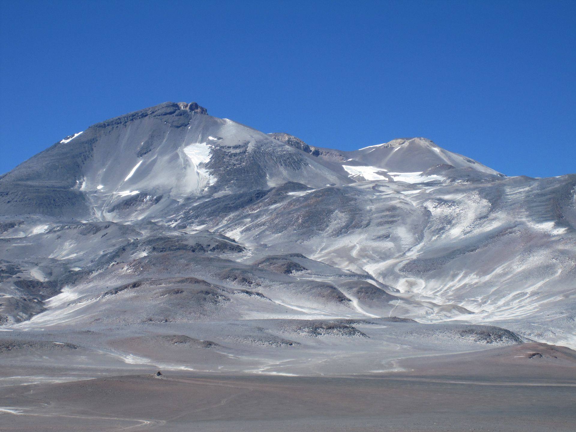
Towering over the Argentine-Chilean border in the heart of the Andes Mountains, Ojos del Salado is the highest volcanic summit on Earth.
With an elevation of nearly 6,900 metres (22,640 feet), the active stratovolcano is also the second-highest summit outside of Asia, with only nearby Aconcagua standing taller.
Due to its location between the Atacama Desert and the spine of the Andes Mountains, the peak tends to be quite dry throughout the year but still generally has snow covering its summit.
As a result of its location, stature and height, Ojos del Salado is one of the most popular mountaineering destinations in South America.
The volcanic peak boasts two main summits, with one being located in Argentina and Chile. While the summit in Chile is slightly higher, there is no appreciable difference in elevation between them. As may be expected, the mountain can be climbed from either side.
Challenges of climbing Ojos del Salado
Ojos del Salado is a trekking peak, which means it does not require technical mountaineering skills to reach the summit. Despite this, there are still several challenges mountaineers will face en route to the summit.
Both altitude and climate provide the main challenges when climbing the peak. With an elevation of 6,893 metres (22,615 feet) and prominence of 3,688 metres (12,100 feet), altitude sickness is one of the main challenges climbers face.
As a result, spending adequate time in the mountains acclimating and being in top physical condition is crucially important to make a successful ascent.
Ojos del Salado’s location on the western slopes of the Andes also presents various climatic challenges for climbers. The ascent begins in the arid and hot climate at the base of the mountain before becoming much colder and windier. Bringing the proper clothing and layers is key to a successful ascent.
How to get to Ojos del Salado
For climbers heading up Ojos del Salado from the Argentine side of the border, it is best to fly into Capitán Vicente Almandos Almonacid Airport (IRJ), in La Rioja, or Coronel Felipe Varela International Airport (CTC), in Catamarca.
Some guides may opt to meet in one of these cities. Otherwise, it is also possible to transfer by bus to Fiambalá, a popular starting point for the climb.
From the Chilean side, it is easiest to fly into Desierto de Atacama Airport (CPO) in Copiapó. Most guides will opt to meet here and provide transport to the start of the trip.
Routes to the summit of Ojos del Salado
Three main routes lead to the summit of Ojos del Salado. Two of these start from the Argentine side of the border, while the easiest and most popular begins on the Chilean side.
Part of the reason for this is the Chilean route begins at a higher altitude and offers more amenities. The ascent via this route starts after driving to the Refugio Atacama at 5,200 metres (17,000 feet).
From here, climbers will hike up the side of the mountain, cutting diagonally across one of its slopes toward the summit. The only challenging part is the very final bit, which requires some previous scrambling experience. While the scrambling itself is not hard, the wind and altitude make it more challenging.
On the Argentine side, the Ruta Varsoviana is the most commonly taken route and is known as the normal route. Beginning from El Arenal, climbers make a steep ascent up the southern side of the mountain before arriving at a saddle. Along the way, climbers should expect some scrambling.
From the saddle, climbers must do some even steeper and more challenging scrambling along the ridgeline, past the base of the summit pyramid and on to the top.
The third route that leads up Ojos del Salado is also the toughest. The Mike Dorse Direct route also begins from El Arenal before veering off to the left and making a steep ice climbing ascent of the peak’s glacier.
Once at the top of the glacier, climbers scramble along the same ridgeline as the Ruta Varsoviana past the summit pyramid and on to the top.
Quick facts:
- Continent: South America
- Location: Argentina/Chile
- Elevation: 6,893 m (22,615 ft)
- Duration: 2 weeks
- Climbing season: December to March
2| Kilimanjaro
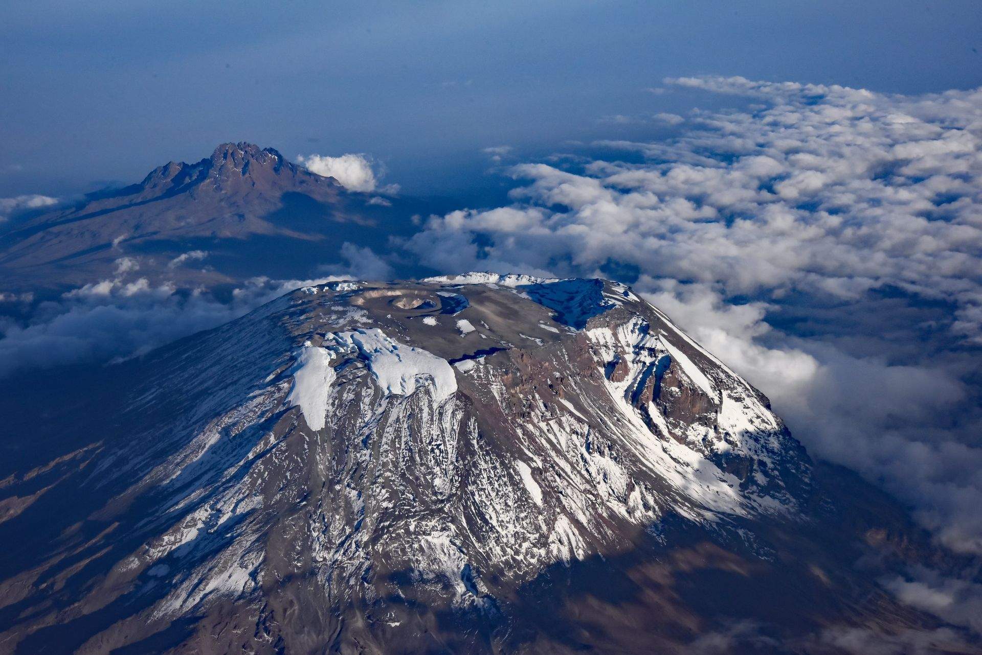
Standing high above the surrounding savanna of East Africa, Kilimanjaro is both the continent’s highest peak and its tallest volcano.
The dormant volcano sits in northeastern Tanzania, near the country’s border with Kenya, and comprises three separate volcanic cones: Kibo, Mawenzi and Shira. Of these, Kibo is the tallest and, therefore, the destination of most climbers headed to the peak.
Located in the heart of an incredibly diverse national park, trekkers heading to the top of Kilimanjaro pass through tropical rainforest, savanna and alpine terrain en route.
Challenges of climbing Kilimanjaro
No technical mountaineering abilities are required to climb Kilimanjaro, making it one of the easiest high-elevation summits. (On the Messner List of the Seven Summits, Kilimanjaro is by far the easiest).
However, there still are various challenges associated with the ascent, especially the elevation. With 5,885 metres (19,308 feet) separating its base from its summit, Kilimanjaro is the fourth most prominent peak on Earth.
As a result, proper acclimatisation and a high level of physical fitness are critical for a successful ascent.
Weather is another challenge. The summit of the peak is frequently below freezing, while the base of the mountain is hot and humid. Bringing all the correct clothing is therefore also important.
How to get to Kilimanjaro
Most trips to Kilimanjaro will begin with a flight into Kilimanjaro Airport (JRO). Most guides will either opt to meet you here or in the nearby city of Arusha.
From either of these two starting points, climbers begin their expedition to the top of the volcanic massif by transferring to one of the various trailheads inside the national park.
What are to the summit of Kilimanjaro
Six main routes lead to the summit of Kilimanjaro: Lemosho, Machame, Marangu, the Northern Circuit, Rongai and Umbwe.
The Marangu Route is the most popularly taken due to its reputation as being among the quickest and easiest. The route is also the only one on the mountain with mountain huts, which adds to its popularity.
However, the route is also one of the steepest, which allows for the lowest time for acclimatisation and therefore has a lower success rate than most of the others.
Away from the Marangu Route, the Machame route is also quite popular. It is considered the easiest up the peak but takes more time to climb, allowing for better acclimatisation and increasing the chances of success. The route is also one of the most scenic and leads climbers through five different climate zones along the way.
The Lemosho Route is considered to be the toughest of the routes. It is longer than the two mentioned above but is more remote. The route also passes through several climate zones and boasts some of the best views in the national park. Its difficulty also means it is away from crowds and provides a more intimate experience with the mountain.
Regardless of the route that is taken to the top, the most challenging part of the climb comes at the end. On summit day, climbers will make a pre-dawn start, ascending steeply up loose volcanic scree and past the edge of the glacier before arriving at the top at mid-morning.
Quick facts:
- Continent: Africa
- Location: Tanzania
- Elevation: 5,895 m (19,341 ft)
- Duration: 1 week
- Climbing season: June to October, January to March
3| Elbrus
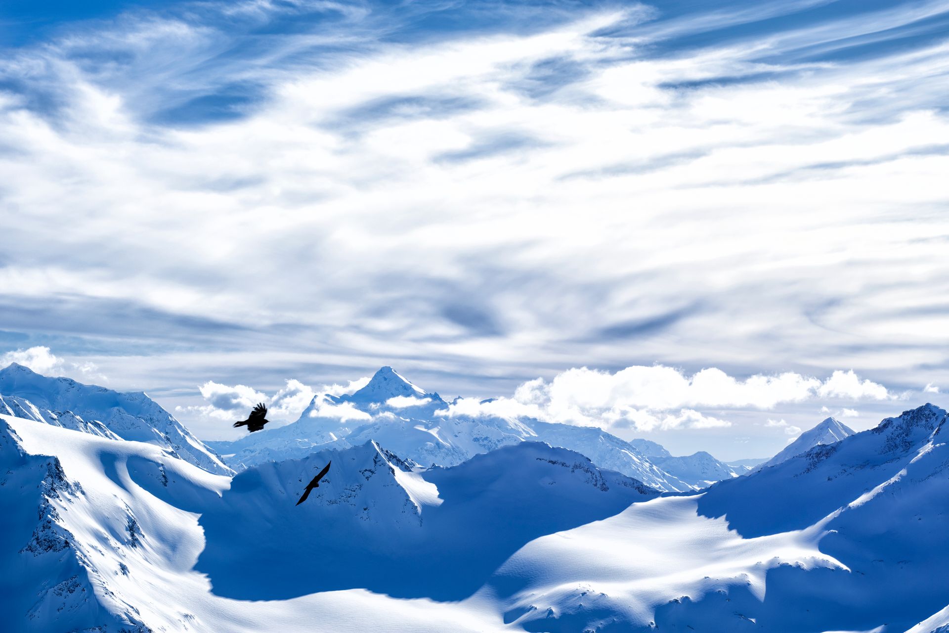
Towering above the surrounding Caucasus Mountains, near Russia’s southern border with Georgia, Mount Elbrus is the tallest and most prominent peak in both Russia and all of Europe.
Along with being one of the world’s seven summits, the dormant stratovolcano is also the tenth most prominent mountain on Earth and therefore an immensely popular mountaineering destination.
Keep reading: Climbing Elbrus and Kilimanjaro: How the First 2 of the Seven Summits compare
The mountain boasts numerous routes up to its summit, with the most simple offering a chairlift part way up to its slopes and more complicated ones beginning from the more remote sides of the mountain.
Challenges of climbing Mount Elbrus
The easiest route to the summit of Mount Elbrus requires some technical rock and snow climbing abilities as the route is rated as Class II. Other routes to the summit of Elbrus are longer and require more technical climbing abilities.
However, the altitude and climate tend to pose more challenges. With a total of 4,741 metres (15,554 feet) from the base to the summit, adequate acclimatisation is required for any successful ascent, along with a high level of physical fitness.
Temperatures on the mountain tend to be below freezing, too, and clouds and storms can quickly envelop the peak. As a result, bringing the proper equipment and having keen route-finding abilities are needed for the climb.
How to get to Mount Elbrus
Most trips to Mount Elbrus begin with a flight into either Nalchik Airport (NAL) or Mineralnye Vody Airport (MRV), both of which can easily be reached from any of Russia’smain cities. Guides will generally meet here before providing transport to the trailhead, which takes between two and 2.5 hours by car.
Routes to the summit
The vast majority of climbers heading to Elbrus take the normal route, which usually begins from either the Garabashi hut or Leaprus hut.
Both of these mountain huts are relatively high up the mountain and can be reached by cable car, which considerably cuts down on the climb time. Climbers, however, may want to consider spending a day hiking up to the Pastukhova rocks and back to acclimate.
On summit day, climbers wake up at midnight and begin the ascent by hiking back up to the Pastukhova rocks. From here, climbers continue for another three to four hours up to the saddle and another 45 minutes onto the summit.
The other route commonly used to climb Elbrus is the Kiukurtliu Route. This way more challenging than the normal route and begins from beneath the cable car station. From here, climbers head west and traverse one of the mountain’s 22 glaciers up to Kiukurtliu Pass.
Before arriving at the pass, climbers will ascend the south spur of the Kiukurtliu Cupola and continue climbing up the broad glaciated saddle. From here, climbers will climb back onto the spur before turning northwest and continuing to the summit.
Quick facts:
- Continent: Europe
- Location: Russia
- Elevation: 5,642 m (18,510 ft)
- Duration: 1 to 2 weeks
- Climbing season: May to September
4| Pico de Orizaba
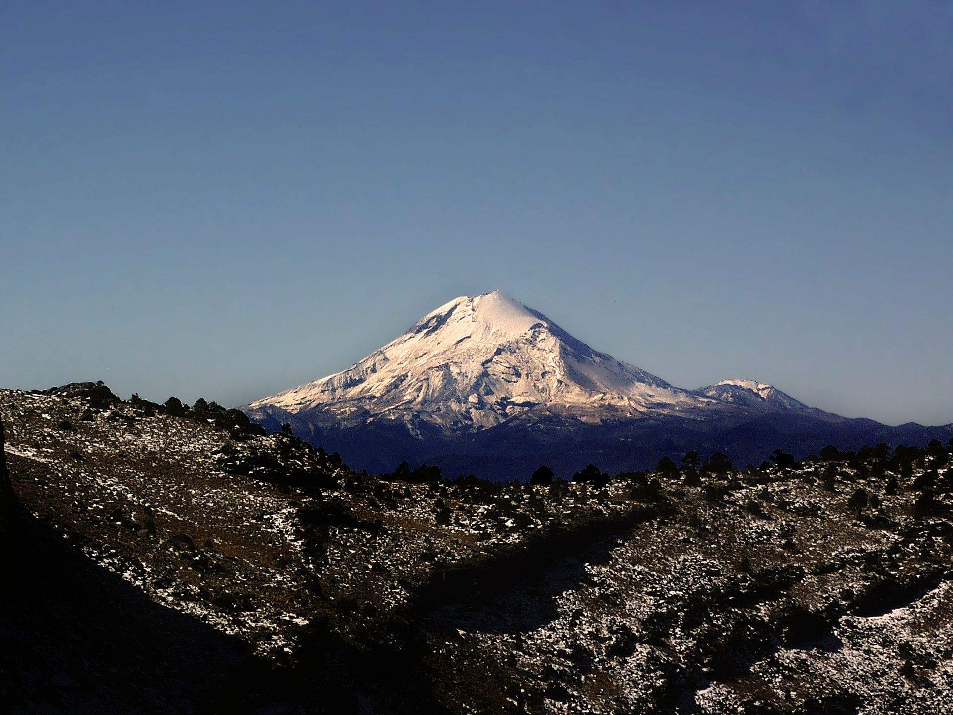
Rising high above the Trans-Mexican Volcanic Belt, Pico de Orizaba is the tallest mountain in Mexico and the third highest in North America.
The dormant stratovolcano stands slightly more than 5,600 metres (18,300 feet) in elevation and is located relatively close to the Gulf of Mexico. The peak is a popular climbing destination for mountaineers preparing for more challenging ascents in the Andes and Alaska Range.
Keep reading: Top Climbing Destinations in Mexico
Boasting 4,922 metres (16,148 feet) from base to summit, Pico de Orizaba is the seventh most prominent mountain on Earth and second most prominent volcano, just behind Mount Kilimanjaro
Due to the elevation and location, the peak has a unique microclimate, with the ascent beginning in a semi-tropical rainforest and ending atop one of the southernmost glaciers of the Northern Hemisphere.
Challenges of climbing Pico de Orizaba
There are three main routes that lead to the summit of Pico de Orizaba, each of which has a slightly different level of difficulty.
The easiest routes only require scrambling in ideal weather conditions and a bit of snow climbing in worse conditions. Previous experience with crampons and an ice ax is necessary, but not much more, technically speaking.
Other routes entail some basic glacier travel abilities and more technical glacier climbing along with some ice climbing abilities. The toughest of these routes is also more exposed, passing along icy cliffs and overhangs. As a result, much more extensive experience is required for these routes.
Regardless of the route taken, all climbers heading to the summit of Pico de Orizaba will need to have a high level of physical fitness. The ascent is steep and along the glacier, there are few places to stop and rest.
How to get to Pico de Orizaba
Any trip to Pico de Orizaba will likely begin with a flight into Mexico City International Airport (MEX) or Puebla International Airport (PBC). From here, most guides will provide transport to the village of Tlachichuca, Ciudad Serdan or Atzinzitla, depending on the route.
Routes to the summit of Pico de Orizaba
The main route up to the summit of Pico de Orizaba is the Jampa Glacier route, which starts from the northwestern side of the volcano. It is the most straightforward route and therefore the most popularly taken.
Most climbers opt to begin from the Piedra Grande Hut at 4,270 metres (14,010 feet), which can be reached on foot or by an all-terrain vehicle. From here, the summit can be reached by climbing straight up the glacier for which the route is named.
Ruta del Sur is another popular route, which heads up the southern side of the mountain. The route avoids the glacier by taking the southern face but sometimes requires snow climbing if the weather has been colder.
The toughest of the three routes is the Serpent’s Head route, which climbs the ice wall on the south side of the mountain and requires three pitches of ascending 10 pitches of grade 3 ice. It is the shortest in terms of distance but certainly the most technical.
Quick facts:
- Continent: North America
- Location: Mexico
- Elevation: 5,636 m (18,491 ft)
- Duration: 2 days
- Climbing season: November to May
5| Damavand
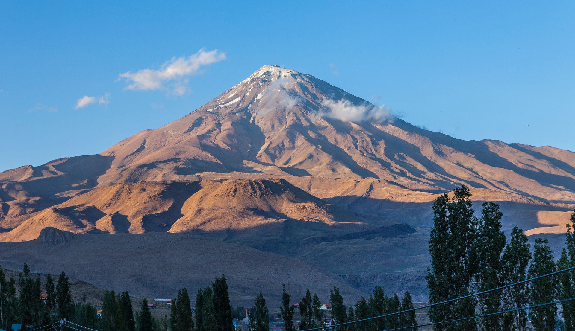
Nestled into the heart of northern Iran’s Alborz Mountains, Mount Damavand is the highest mountain in Iran and the twelfth most prominent peak on Earth.
Situated not far north of the capital Iran, Damavand boasts relatively easy access along with stunning views over the rest of the range and all the way out to the Caspian Sea.
With 4,667 metres (15,312 feet) separating the base of the peak from its summit, Damavand is also the second most prominent mountain in Asia. It is an excellent mountaineering destination for intermediate climbers seeking out experience at high elevations.
The potentially active volcano requires no technical difficulty to climb, making it a popular ski mountaineering and ski tourist destination.
Challenges of climbing Mount Damavand
While climbing Mount Damavand requires no technical abilities, there are plenty of other challenges to overcome en route to the summit.
As the spring is the best time to climb (due to scorching summertime temperatures), the mountain is usually covered in snow. Depending on conditions, crampons and ice axes may be needed. Though, all the necessary skills can generally be taught at the start of the trip.
The climb also requires a very high level of physical fitness and proper acclimation. Climbers arriving at the peak from Tehran are advised to spend some time near base camp adjusting to the altitude.
Summit day comprises a very long ascent of 1,400 vertical meters. The route is quite steep and due to the exposed nature of the mountain at this elevation, there are few places to stop and rest along the way.
Conditions can also be cold and windy during the spring. Bringing the necessary layers of clothing can be the difference between a comfortable climb and freezing failure.
How to get to Mount Damavand
Almost all trips to Mount Damavand begin with a flight into Imam Khomeini International Airport (IKA) in Tehran. Guides will almost exclusively meet here and provide transport to the start of the trip – usually Rineh or Polur, depending on the route being taken.
Routes to the summit of Mount Damavand
There are about 16 different routes that lead to the summit of Mount Damavand. However, only four of these routes are most commonly climbed.
Of the four main routes, the south face route is the easiest to climb. From the Goosfandsera hut, at roughly 3,000 metres (9,800 feet), climbers will follow a series of curved ridges to the second shelter at 4,200 metres (13,800 feet). On summit day, climbers will follow the southern ridge straight up to the summit.
Away from the southern route, the western route is also quite popular. Starting from Polur village, climbers will enjoy a long but relatively easy hike up to the Simorgh hut at 4,200 metres. The following day, climbers will follow a rocky ridge up toward the summit. Just before, arriving at the top climbers will traverse a part composed of sandy soil. This is the hardest part of the climb.
The north face route and northeast route are the two most challenging of the main routes taken. This is partly because the northern side of the mountain tends to be colder and windier.
The north face route is also the steepest route and requires three days of steep climbing, stopping off at two separate huts en route to the summit. Depending on the weather conditions, some technical glacier and snow climbing may be required to make it to the top.
The northeast route is the longest route to the summit and requires some technical mountaineering skills, including rock and glacier climbing. It is also the most remote of the main routes and provides excellent views throughout the climb.
Quick facts:
- Continent: Asia
- Location: Iran
- Elevation: 5,610 m (18,406 ft)
- Duration: 1 week
- Climbing season: April to May
6| Mount Giluwe
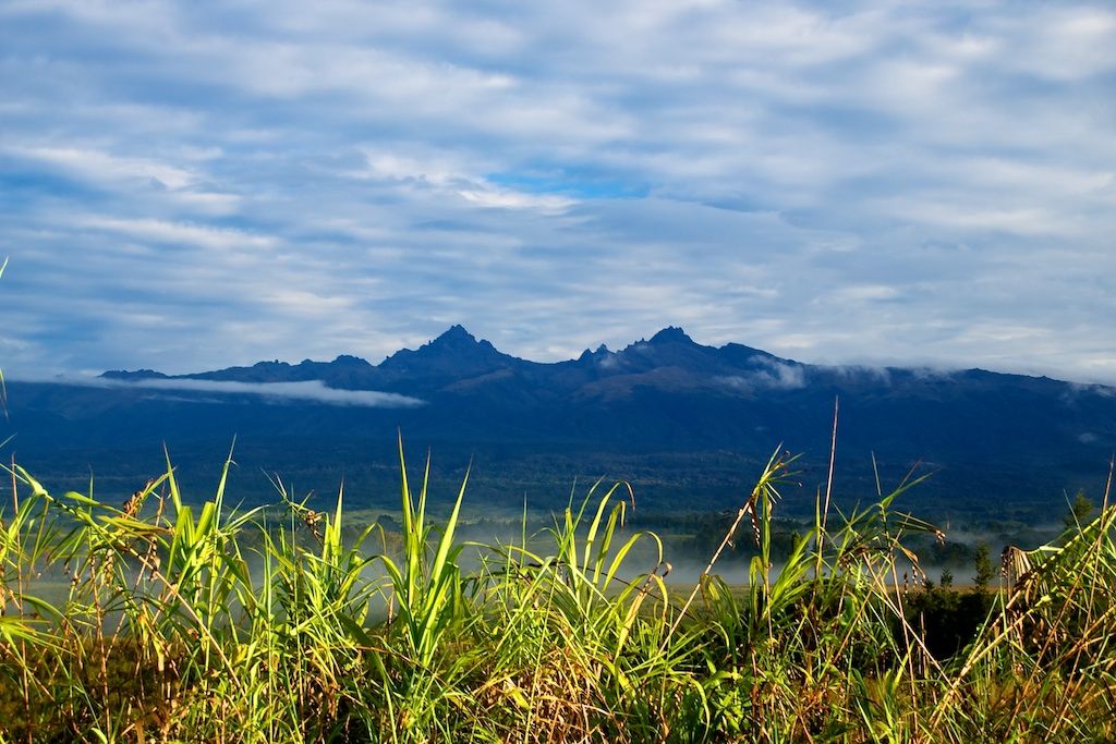
Situated in the heart of Papua New Guinea’s Southern Highlands, Giluwe is the second highest mountain in the country and fifth-highest on the island, which is shared with Indonesia.
The eroded shield volcano boasts two separate summits, which are actually two ancient volcanic plugs. The central peak is the highest of the two and sits about two kilometres (1.2 miles) away from the slightly-lower east summit.
The majority of the ancient shield volcano, which is estimated to be nearly one million years old, is covered in alpine grasslands. Despite its location close to the equator, Giluwe frequently receives frost and even some snow at night.
Challenges of climbing Mount Giluwe
While Mount Giluwe is not a technically challenging mountain to climb, climbers must face several significant challenges en route to the summit.
The peak is very remote and requires a long day of trekking from an already remote village to reach the base camp. The trek involves hiking through a thick jungle and requires a good level of physical fitness. Climbers also must haul all the camping and climbing gear to the base camp.
In spite of its modest size, the peak is relatively prominent, with 2,507 metres (8,225 feet) separating its base from its summit. This means proper acclimatisation is key to a successful ascent of the peak.
How to get to Mount Giluwe
Any trip to Mount Giluwe begins with a flight into Port Moresby International Airport (POM). Most guides will opt to meet here before taking a domestic flight to Mount Hagen Airport (HGU). From here, climbers will drive to the Mailka.
Routes to the summit of Mount Giluwe
Most ascents of Mount Giluwe follow one main route. Starting from Mailka, climbers will spend one day trekking through thick jungle, steadily gaining altitude until the trees give way to alpine grasslands and base camp is reached.
The following day is summit day. Climbers will mostly hike but may need to employ some basic scrambling on some of the peak’s volcanic scree. While the climbing is not particularly long, the ascent takes about three or four hours from base camp.
Most expeditions get a pre-dawn start to watch the sunrise from the summit and return to Mailk before the end of the day.
Quick facts:
- Continent: Oceania
- Location: Papua New Guinea
- Elevation: 4,368 m (14,331 ft)
- Duration: 1 week
- Climbing season: July to October
7| Mount Sidley
.jpg)
Towering over the four neighbouring peaks that compose the Executive Committee Range, Mount Sidley is the fifth highest mountain in Antarctica and among the world’s most remote and rarely climbed mountaineering destinations
The dormant stratovolcano is located in Marie Byrd Land, at the base of the Antarctic Peninsula. It features a five-kilometre (three-mile) wide caldera on the southern portion of the peak.
While Mount Sidley is Antarctica’s tallest volcano, very little is known about the peak. The continent’s second-highest volcanic summit, Mount Erebus, is a much more popular climbing destination due to its proximity to the United States and New Zealand bases on Ross Island.
Challenges of climbing Mount Sidley
Mount Sidley boasts several different challenges, from logistics to technical difficulties, making it one of the most challenging mountains to climb anywhere.
The peak is located about 1,000 kilometres away from the nearest human settlement on the continent, which means any expedition is well and truly on its own once they have flown out to set up base camp. As a result, expeditions will need to be completely self-sufficient and prepared for anything.
Even though Mount Sidley is climbed in the winter, the weather conditions are still extremely cold and dry, so climbers will need to be prepared for this.
A high level of physical fitness and proper acclimatisation are required. About 2,517 metres (8,258 feet) separate the base of the peak from its summit. Climbers will also be required to haul their own gear and communal gear from the base camp to the intermediary camp on the mountain.
In terms of technical difficulty, even the most basic route will require glacier climbing techniques. More advanced routes will need some ice climbing techniques as well. Overall, the expedition is best suited to upper-intermediate-level mountaineers.
How to get to Mount Sidley
Any trip to Mount Sidley generally begins with a flight into Presidente Carlos Ibáñez del Campo International Airport (PUQ) in Punta Arenas, Chile. Most guides will opt to meet here before transferring to American Union Glacier airbase in Antarctica’s Ellsworth Mountains.
From here, climbers will take a separate flight 900 kilometres (560 miles) west to the Executive Committee Range and set up base camp there.
Routes to the summit of Mount Sidley
Two main routes lead up to the summit of Mount Sidley. The easier of these routes climbs the peak from the north. This route is long but not too steep and requires little technical climbing abilities. The west ridge route is much steeper and more technically challenging, though it is a bit shorter.
Regardless of the route taken to reach the summit, climbers will need to set up two intermediate camps, which help with acclimatisation.
After climbing to the summit and enjoying the stunning views over the continent, some climbers may opt to ski back down to the intermediary camps and on to base camp.
Quick facts:
- Continent: Antarctica
- Elevation: 4,285 m (14,058 ft)
- Duration: 3 weeks
- Climbing season: January
Start planning your next adventure now!
For any experienced mountaineer seeking out their next challenge, the Seven Volcanic Summits are the perfect opportunity. Compare trips to each of these exotic destinations with ExpedReview and begin planning your next adventure today!