Top Treks in the Annapurna Conservation Area, Nepal: Routes, Permits and Best Time
By Blake Penson · August 3, 2022
Category: destination-guides
8 min read
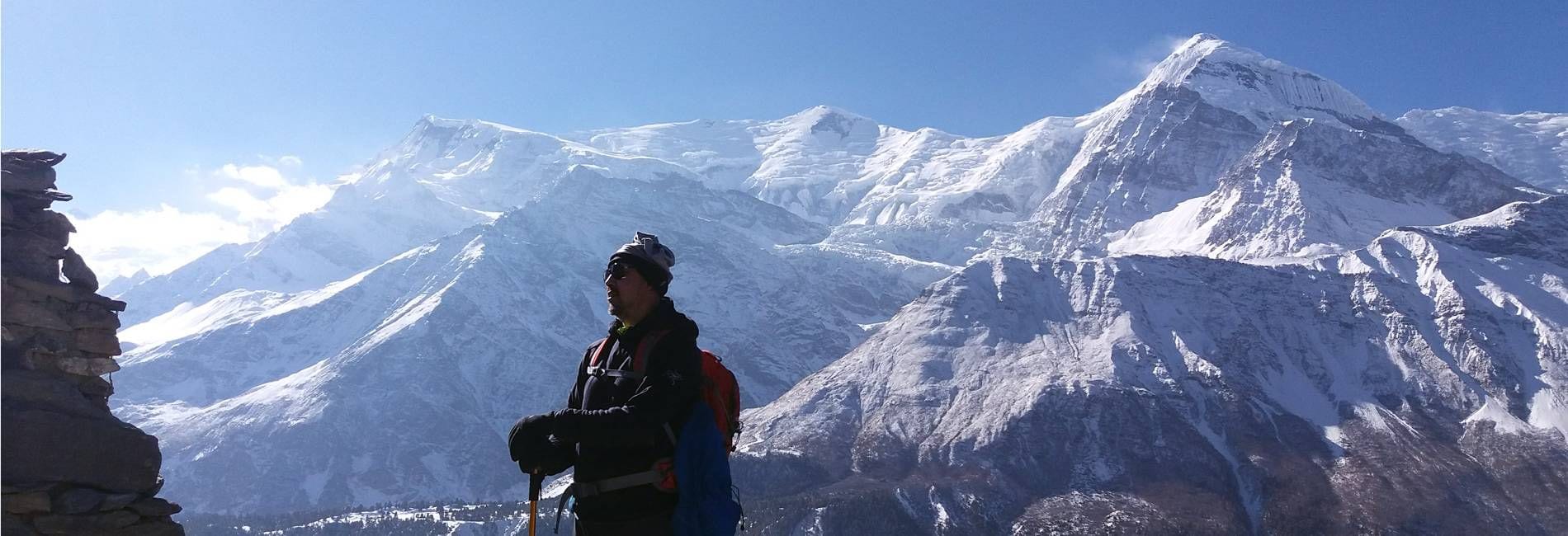
The Annapurna Conservation Area is Nepal's largest protected area, covering about 7,629 km² of north-central Nepal around the Annapurna massif, and it is the country's most popular trekking region. The best treks are the Annapurna Circuit (about 12 to 18 days, crossing the 5,416 m Thorong La), Annapurna Base Camp (about 7 to 12 days, to 4,130 m), the Poon Hill trek (3 to 5 days, to 3,210 m), Mardi Himal (4 to 7 days, to about 4,500 m), the Tilicho Lake side trip from the Circuit (to about 4,920 m) and the quieter Khopra Ridge. Every trekker needs an Annapurna Conservation Area Project (ACAP) permit, which costs NPR 3,000 for foreign nationals and NPR 1,000 for SAARC nationals, and since 2023 foreign trekkers must go with a licensed guide. The best seasons are October to November and March to May. Below, we compare each trek and explain how to choose one.
| Trek | Typical days | Highest point | Difficulty | Best for |
|---|---|---|---|---|
| Poon Hill (Ghorepani) | 3–5 | Poon Hill, 3,210 m | Easy–moderate | Short trips, families, first treks |
| Mardi Himal | 4–7 | Mardi Himal Base Camp, about 4,500 m | Moderate | Fewer crowds, ridge views |
| Annapurna Base Camp | 7–12 | ABC, 4,130 m | Moderate | Mountain amphitheatre, classic trek |
| Khopra Ridge | 6–9 | Khopra Ridge, about 3,660 m (Khayar Lake about 4,500 m) | Moderate | Quiet, community lodges |
| Annapurna Circuit | 12–18 | Thorong La, 5,416 m | Moderate–challenging | A full circuit, varied landscapes |
| Tilicho Lake (Circuit side trip) | +2–3 | Tilicho Lake, about 4,920 m | Challenging | High-altitude lake |
| Upper Mustang | 10–14 | About 3,800–4,000 m | Moderate | Tibetan culture, desert landscapes (restricted area permit) |
Altitudes are approximate and vary between sources. Days are walking days and depend on your start and end points, transport and acclimatisation.
About the Annapurna Conservation Area
The Annapurna Conservation Area Project (ACAP) began in 1986 as Nepal's first conservation area project and is managed by the National Trust for Nature Conservation, a non-government organisation, rather than by the national park service. Unlike Nepal's national parks, people live and farm inside the conservation area, and the model was designed to involve local communities in conservation and tourism. Your permit fee helps fund conservation, trail maintenance and community programmes.
The area ranges from subtropical forest below 1,000 m to the high Himalaya above 8,000 m, and includes the dry, Tibetan-influenced landscapes of Manang and Mustang behind the main range. The Nepal Tourism Board reports that it is home to 102 species of mammals, 474 species of birds, 39 reptiles and 22 amphibians, including snow leopards and the Himalayan musk deer (secondary source).
The main peaks are Annapurna I (8,091 m), the first 8,000 m mountain ever climbed, in 1950; Dhaulagiri (8,167 m) across the Kali Gandaki valley; Machapuchare (6,993 m), the "Fishtail", which is closed to climbing; and Hiunchuli, Annapurna South and Gangapurna. Between Annapurna and Dhaulagiri, the Kali Gandaki cuts one of the deepest gorges in the world. See the Annapurna region and Annapurna I.
Annapurna Circuit
The Annapurna Circuit is one of the world's great treks. It follows the Marsyangdi valley north and west around the Annapurna massif, through rice terraces, pine forest and the dry, high valley of Manang, then crosses the Thorong La at 5,416 m before dropping to the pilgrimage site of Muktinath and the Kali Gandaki valley.
Road building has changed the Circuit. Roads now reach much of the route, and many trekkers start higher in the Marsyangdi valley and finish at Muktinath or Jomsom, flying or driving out. That shortens the trek to about 10 to 14 days, but it reduces your acclimatisation time, so build in rest days at Manang (about 3,540 m) before the pass. Alternative paths avoid many road sections.
Thorong La is the crux. The pass is long and high, and should be crossed early in the morning before wind picks up. Weather is the main danger: in October 2014, a sudden storm linked to the remnants of Cyclone Hudhud killed more than 40 people, including trekkers, guides and porters, in the Thorong La area and elsewhere in the region. Check the forecast and be ready to wait. See our full Annapurna Circuit trek page and the circuit trek page.
Tilicho Lake
From Manang, a popular side trip leads to Tilicho Lake, at about 4,920 m one of the highest lakes of its size in the world. The trail passes landslide-prone slopes on the way to Tilicho Base Camp (about 4,150 m), and the lake is usually visited on a day trip from there. Some trekkers then continue over a high route to Jomsom, but that crossing is more serious and needs a guide, good conditions and experience. Adding Tilicho to the Circuit takes two to three extra days and is also good acclimatisation before the Thorong La.
Annapurna Base Camp
The Annapurna Base Camp (ABC) trek, also called the Annapurna Sanctuary trek, leads into a natural amphitheatre of high peaks. The trail climbs through Gurung villages such as Ghandruk and Chhomrong and bamboo and rhododendron forest, then up the Modi Khola gorge past Machapuchare Base Camp (about 3,700 m) to ABC at 4,130 m, surrounded by Annapurna I, Annapurna South, Hiunchuli and Machapuchare.
The trek usually takes about 7 to 12 days from Pokhara, depending on road access and whether you combine it with Poon Hill. The upper valley is exposed to avalanches from the steep slopes above, particularly after heavy snowfall, and the trail is sometimes closed. Respect local warnings. See the Annapurna Base Camp trekking guide and the base camp trek page.
Poon Hill
The Poon Hill trek is the most popular short trek in the region and an excellent first trek in Nepal. It climbs from the Nayapul or Tikhedhunga area through terraced villages and rhododendron forest to Ghorepani, from where you climb before dawn to Poon Hill (3,210 m) for sunrise over Dhaulagiri, Annapurna South and Machapuchare.
The trek usually takes three to five days. It stays below about 3,200 m, so the risk of serious altitude sickness is low. It is busy in peak seasons, and rhododendrons bloom in spring. It combines well with ABC via Tadapani and Chhomrong. See the Poon Hill page.
Mardi Himal
The Mardi Himal trek became popular after the route was opened to trekkers with new lodges around 2012. It follows a ridge east of the Modi Khola from near Pokhara through forest to Low Camp, High Camp (about 3,580 m) and a viewpoint or base camp at about 4,500 m beneath Mardi Himal and Machapuchare.
It takes about four to seven days and is quieter than ABC or the Circuit, with close views of Machapuchare. The upper ridge is exposed to wind and snow, and lodges are basic. See the Mardi Himal page.
Khopra Ridge
The Khopra Ridge trek leaves the main Poon Hill trail and climbs to Khopra Ridge (about 3,660 m), with views of Dhaulagiri and Annapurna South. A side trip goes to Khayar Lake, a sacred lake at about 4,500 m. The route uses community-run lodges, so more of your money stays in local villages. It takes about six to nine days. See the Khopra Ridge page.
Upper Mustang
Upper Mustang, the former Kingdom of Lo, lies north of the main range in a dry, Tibetan-influenced landscape of canyons, cliffs and cave dwellings. It is a restricted area: as well as the ACAP permit, foreign trekkers need a special restricted area permit, now US$50 per person per day according to the Nepal Tourism Board, and must travel with a licensed guide arranged through a registered agency (solo trekkers have been allowed since March 2026). The trek usually takes 10 to 14 days from Jomsom, reaching Lo Manthang at about 3,800 m. See the Upper Mustang page.
Other treks and climbs
- Lamjung Base Camp and Saribung are quieter routes for experienced trekkers. See Lamjung Base Camp and Saribung.
- Himlung Himal (7,126 m), on the border near Nar Phu, is a popular first 7,000 m peak. See Himlung.
- Nar Phu is a restricted-area side valley off the Circuit with traditional villages.
Permits, fees and the guide rule
- ACAP permit: NPR 3,000 for foreign nationals and NPR 1,000 for SAARC nationals. It is bought in Kathmandu or Pokhara. Buying it at a checkpoint without one costs double.
- TIMS card: NPR 2,000 for foreign trekkers, issued through a registered agency.
- Guide rule: from 1 April 2023, the Nepal Tourism Board requires foreign trekkers in national parks and conservation areas to trek with a licensed guide arranged through a registered trekking company.
- Restricted areas such as Upper Mustang and Nar Phu need special permits and minimum group sizes.
Fees and rules change, so check with the Nepal Tourism Board or your trekking company before you go.
When to go
- October to November: clear skies after the monsoon, stable weather and the busiest trails.
- March to May: warmer weather and rhododendron blooms; more haze and afternoon cloud.
- December to February: cold, quieter trails, with snow possible on high passes; Thorong La and upper ABC may be closed.
- June to September: monsoon rain, leeches and landslides on the south side. Upper Mustang, in the rain shadow, is a good monsoon option.
Altitude and safety
Several of these treks go high enough for altitude sickness. Follow standard guidance: above about 3,000 m, increase sleeping altitude by no more than about 300 to 500 m a day, take rest days, and descend if symptoms worsen. Watch for headache, nausea and fatigue, and know the signs of HACE and HAPE. See what is acute mountain sickness. Get insurance that covers trekking at altitude and helicopter rescue.
Other hazards include landslides, river crossings and avalanches, especially in the upper ABC valley, and sudden storms on Thorong La. Check conditions before you set out.
Getting there
Pokhara, Nepal's second tourist hub, is the gateway to the conservation area. It is about 200 km west of Kathmandu, reached by a short flight or a long bus or jeep journey. From Pokhara, jeeps and buses run to trailheads such as Nayapul, Kande and Phedi for the southern treks, and along the Marsyangdi valley for the start of the Circuit. Jomsom, on the western side, has an airstrip with flights from Pokhara, but mountain weather often delays them, so leave spare days in your plans.
Teahouses, food and daily life on the trail
Most treks in the conservation area are teahouse treks: you sleep in family-run lodges and eat in their dining rooms, so you do not need to carry a tent or stove. Rooms are usually simple twin rooms with shared bathrooms; higher up, they become more basic and colder, and hot showers, charging and Wi-Fi cost extra. Prices for food rise with altitude because supplies are carried in by porters or mules. Dal bhat, rice with lentil soup and vegetables, is the staple and usually comes with refills. Carry cash in Nepali rupees, because ATMs are rare beyond the main towns.
Trekking responsibly
The conservation area model depends on local communities benefiting from tourism. Use local lodges and guides, carry out your rubbish, avoid single-use plastic bottles by treating water, stay on trails, and respect shrines, prayer walls and monasteries by passing them clockwise. Ask before photographing people.
How to choose your trek
- Short trip or first trek: Poon Hill.
- Up close with big mountains in a week or so: Annapurna Base Camp or Mardi Himal.
- A big journey with changing landscapes: the Annapurna Circuit, with Tilicho Lake if you have time.
- Quiet trails and community lodges: Khopra Ridge.
- Culture and desert landscapes: Upper Mustang.
Frequently asked questions
What is the Annapurna Conservation Area?
It is Nepal's largest protected area, about 7,629 km² in north-central Nepal, managed by the National Trust for Nature Conservation since the Annapurna Conservation Area Project began in 1986.
What is the best trek in the Annapurna region?
It depends on your time and experience. The Annapurna Circuit is the classic long trek, ABC is the best for close-up mountain views, and Poon Hill is the best short trek.
How much is the Annapurna Conservation Area permit?
NPR 3,000 for foreign nationals and NPR 1,000 for SAARC nationals. A TIMS card costs NPR 2,000 for foreigners.
Do I need a guide in the Annapurna Conservation Area?
Yes. Since 1 April 2023, foreign trekkers must trek with a licensed guide arranged through a registered trekking company.
Which Annapurna trek is easiest?
Poon Hill is the easiest popular trek, taking three to five days and staying below about 3,200 m.
When is the best time to trek in the Annapurna region?
October to November and March to May. Upper Mustang can also be trekked in the monsoon.
How high is Thorong La?
Thorong La, the high pass on the Annapurna Circuit, is 5,416 m.
Tags: annapurna, nepal, trekking, poon-hill, annapurna-circuit