Top Polar Mountaineering and Ski Touring Destinations
The desire to explore the Arctic and Antarctica has long permeated the human spirit and continues today.
The first documented attempt to reach the North Pole dates back to the fourth century BCE. Greek explorer Pytheas went in search of the source of the tin that occasionally arrived in his city and sailed north. Historians believe that he got as far as Norway or the Shetland Islands and saw both the Northern Lights and the Midnight Sun.
This desire to reach the top of the world continued unrelentingly until Alexander Kuznetsov and a team of Soviet explorers became the first people to walk on the North Pole in 1948 undisputedly. The pole had previously been seen from the air, and American explorer Robert Pearly claimed to have reached it in 1909, but this was disputed.
Over the past couple of decades, intrepid ski tourers have sought to retrace Kuznetsov’s footsteps and explore increasingly more of the polar region.
Meanwhile, Antarctica has also long captured the imagination of explorers, with Europeans beginning to search for the then mythical continent by the end of the 1400s. However, it would take another 400 years before anyone set foot on the continent.
Once this first step was taken, it would not take long for the race to the bottom to begin. In 1910, Norwegian Polar explorer Roald Amundsen became the first person to reach the South Pole, narrowly beating British explorer Robert Scott’s expedition.
Along with the North Pole, the South Pole and Antarctica, in general, have become increasingly popular for top mountaineers and ski tourers to explore. The former opt to take on the tallest mountains on the continent, while the latter ski to the bottom of the world, repeating an abridged version of Amundsen’s feat.
Heading to either polar region is sure to be the adventure of a lifetime. However, these expeditions are immensely challenging. All of them require explorers to be self-reliant and haul all of their gear, so a high level of physical fitness and mental fortitude is required.
All expeditions will require months of training to be fully ready to take them on but offer ample rewards for those who do. Below, we have described what it takes to head on one of these expeditions and some of the top locations to visit around both poles.
How to get started
Mountaineering and ski touring are fun and healthy ways to get out of doors and explore the natural world. However, few people are prepared to make a polar skiing or climbing expedition their first one.
Heading to the top or bottom of the world requires dedication and years of training, and, like any other sport, it is best to start small before working up to bigger challenges.
Aspiring mountaineers and ski tourers should consider booking trips to beginner destinations. These spots are generally relatively high in altitude (3,000 metres/10,000 feet or more) and glaciated.
Among the most popular examples are Mount Baker in Washington state, Gran Paradiso in north-western Italy, and Lanín Volcano on the Argentine-Chilean border. Experienced mountain guides select peaks such as these because they have many of the same obstacles and features of the top polar ski touring and mountaineering destinations – glacier travel, crevasses and a substantial change in altitude – just on a much smaller scale.
From here, would-be polar explorers can matriculate to tougher peaks. As their mountaineering skills continue to grow, so too will the strength and endurance required to haul gear, climb steep inclines and travel continuously for hours at a time without much rest.
Unique challenges of a polar expedition
Once climbers and ski tourers master the basics and can take on tougher expeditions, they may be ready for a pre-polar expedition. These are usually done in glaciated areas to prepare would-be polar explorers for the specific challenges associated with these extreme environments.
While each location presents its own unique challenges, all polar destinations have extreme and harsh weather conditions in common. For trips to Antarctica in the summer and skiing expeditions above the Arctic Circle in the spring, expect temperatures to dip below –30 ºC (–22 ºC), excluding wind chill.
Along with freezing temperatures, weather conditions can change quickly at the poles, going from sunny days to complete whiteouts in minutes. As a result, participants need to be mentally and physically prepared to deal with these conditions.
Depending on which pole participants opt to explore, they will also run into another significant challenge. The exploration season in Antarctica is during the summer, which means the sun does not set. This means participants are at severe risk of sunburn and also makes sleeping more of a challenge.
Meanwhile, ski touring expeditions above the Arctic Circle take place in the spring. Depending on how far north the expeditions occur, the amount of daylight will range from the standard amount to nearly all day.
What to bring on a polar expedition
Once climbers are technically and physically prepared to climb one or more of the Seven Summits, the next step is to bring all of the correct gear.
While equipment lists will change based on the mountain and the guide service, below is a checklist of essential mountaineering and ski touring gear required on most polar expeditions.
Climbing, skiing and camping gear
- 20 to 60-litre climbing pack
- Ice axe
- Crampons
- Carabiners
- Belay device
- Climbing harness
- Rope
- Avalanche rescue gear
- Crevasse rescue gear
- Headlamp and extra batteries
- Four-season tent
- Thermal sleeping bag
- Sleeping pad
- First aid and toiletries
- ID card, visas and necessary permits
- Skis
- Ski poles
- Ski helmet
Footwear
- Gaiters
- Hiking socks and liner socks
- Mountaineering boots
- Street shoes or sandals for base camp
Headwear
- Lots of Neck Gaiters (also known as Buffs)
- Mountaineering goggles
- Mountaineering helmet
- Knit cap
- Category 4 sunglasses (for snowy conditions)
- Sunhat
Clothing
- Base-layer bottom and top
- Softshell pants and hard-shell pants
- Softshell jacket, mid-layer top and hard-shell jacket
- Lightweight insulated jacket
- Insulated down parka
- T-shirts, shorts and trousers for base camp
- Nightwear and underwear (long underwear is preferable for camping on mountains)
- Liner gloves and mountaineering gloves
Eating and drinking
- One-litre water bottle
- Water purification tablets and/or a Steripen
- Backpacking stove and fuel
- Cooking and eating utensils
- Energy snacks
- Hot drink mix
- Collapsible water container
- Thermos
- Biodegradable soap
Remember, some guides will provide some or all of the necessary equipment, while others will not. Therefore, it is always best to ask the guide for a checklist before packing for an expedition.
1| South Pole
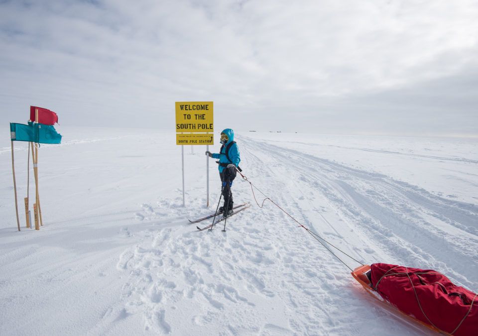
Located at the point where the Earth’s axis of rotation intersects with the surface, the South Pole is the southernmost point on the planet and one of the world’s most amazing ski touring destinations.
Located at the heart of Antarctica atop a windswept plateau, the South Pole is often combined with expeditions to the North Pole and the Seven Summits as part of the Explorers Grand Slam.
Adventurers headed to the bottom of the world – where the sun does not set during the summer and there is technically no time – start the adventure from the 89th parallel and slowly make their way to the United States Amundsen-Scott South Pole Station.
A barber pole surrounded by flags marks the ceremonial South Pole. This is usually located a few metres away from the actual south pole due to the ever so slight movement of the ice sheet across the continent.
Challenges of skiing to the South Pole
The South Pole is considered to be one of the most challenging ski touring destinations in the world.
Ski tourers planning to head to the bottom of the world must be competent off-piste skiers with previous polar experience. To that end, most guides require prospective participants to take a polar skills course before booking their trip.
Along with technical abilities, ski touring to the South Pole requires a very high level of physical fitness. Ski tourers haul sleds containing their gear and some communal gear for the duration of the trip, the first half of which steadily climbs uphill from the edge of Antarctica to its centre.
How to get to the South Pole
The vast majority of trips to the South Pole will begin with a flight into Presidente Carlos Ibáñez del Campo International Airport (PUQ) in Punta Arenas, Chile. Here, guides generally charter two flights: the first onto Antarctica and the second to the base that serves as the start of the expedition to the South Pole.
Routes to the South Pole
Most guides take one main route to the South Pole. Most expeditions start with a flight to the camp at the 89th parallel. From here, ski tourers will ski 111 kilometres (69 miles) to the South Pole.
Along the way, ski tourers will traverse many sastrugi, or steep snow ridges formed by wind, as they make their steady ascent to the South Pole at 2,835 metres (9,301 feet) of elevation.
After five days of travel, during which ski tourers will travel for eight to nine hours each day in one-hour blocks, participants arrive at the Amundsen-Scott Station. Once at the station, ski tourers will visit a few points of interest and scenic vistas before skiing back down the 8th parallel.
Quick facts:
- Location: Antarctica
- Elevation: 2,835 m (9,301 ft)
- Duration: 2 weeks
- Climbing season: December to January
2| Vinson
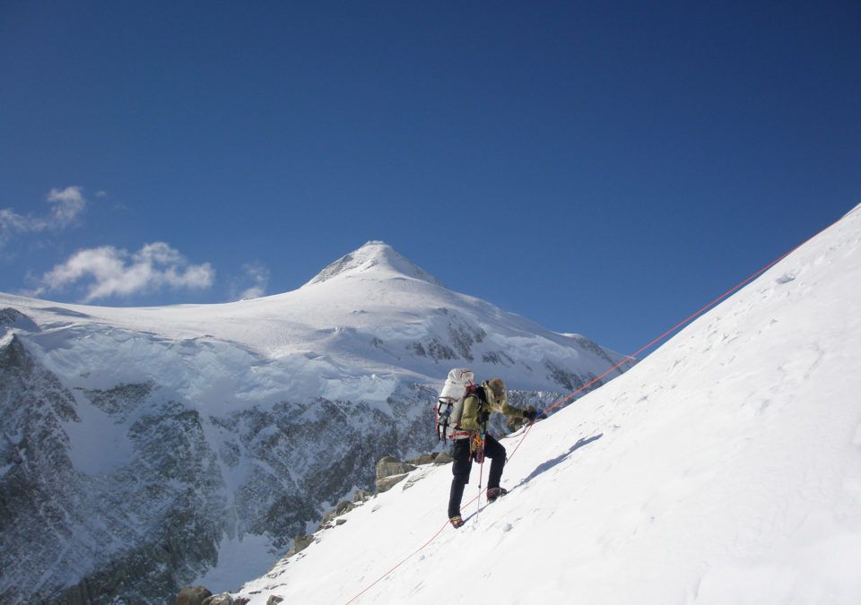
Situated at the base of the Antarctic Peninsula, Mount Vinson is the highest peak on its homonymous massif and the tallest mountain in Antarctica.
Reaching an elevation of 4,892 metres (16,050 feet), Vinson is the second shortest of the Seven Summits but one of the most challenging.
Along with its remote location, nestled amongst the Ellsworth Mountains overlooking the Ronne Ice Shelf, Vinson is the eighth most prominent mountain on earth. The combination makes any ascent to the peak’s summit a long and challenging undertaking.
Despite all this, Vinson remains the most popular climbing destination in Antarctica, offering incredible views of the continent’s pristine landscapes and providing an unparalleled wilderness experience.
Challenges of climbing Vinson
Mount Vinson is not a very technically challenging peak to climb but presents plenty of other challenges.
Vinson is rated with an intermediate difficulty from a technical standpoint, similar to other intermediate-level peaks in the Alps. Climbers will need basic glacier climbing skills and some ice climbing abilities, but not much more.
The real challenge of climbing Vinson comes down to its location and how remote it is. The sheer isolation means climbers must be self-sufficient and haul all their gear from the starting point to the high camps and back. As a result, climbers must be in excellent physical condition.
How to get to Vinson
Any expedition to Mount Vinson generally begins with a flight into the international airport in Punta Arenas (PUQ), Chile. Most guides will opt to meet up in the city and charter a flight to Union Glacier in Antarctica. From here, climbers will transfer to the base camp at Branscomb Glacier.
Routes up Vinson
One main route leads up to the summit of Vinson. Starting from base camp, climbers traverse the Branscomb Glacier before arriving at the low camp.
From here, more technical ice climbing is needed to reach the top of a ribbed wall before traversing another glacier and arriving at the high camp, which is located on a small plateau.
From here, climbers will conclude the ascent by heading up the final cwm and reaching the top. Once on the summit, it is possible to descend the same route or ski back down a different one.
Quick facts:
- Location: Antarctica
- Elevation: 4,892 m (16,050 ft)
- Duration: 3 weeks
- Climbing season: December to January
3| Sidley
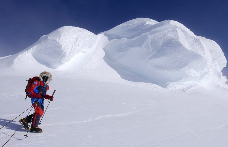
Situated about 1,000 kilometres (620 miles) west of Mount Vinson, at the heart of the Executive Committee Range, Mount Sidley is the fifth highest peak on Antarctica and the continent’s tallest volcano.
Due to its immensely remote location and technical challenges, the dormant stratovolcano is also one of Antarctica’s least climbed peaks but is perfect for advanced mountaineers looking for a challenge.
Despite its stature as one of the Seven Volcanic Summits, very little is known about Sidley. Many mountaineers headed to western Antarctica instead opt to climb Mount Erebus.
The peak, which is the second-highest volcano, is located more than 1,000 kilometres west of Sidley, nearby bases belonging to the United States and New Zealand.
Challenges of climbing Sidley
Mountaineers face plenty of challenges when heading to Mount Sidley, ranging from the logistics associated with the expedition to the technical climbing.
Due to its remote location, there is no infrastructure around Sidley. As a result, mountaineers need to bring and haul all their gear throughout the trip. The remote location also means expeditions must be self-sufficient and ready for anything.
From a technical standpoint, even the most accessible route requires glacier climbing abilities, with tougher routes requiring ice climbing skills too. As a result, the expedition is usually rated as upper-intermediate in terms of technical difficulty.
Along with the logistical and technical challenges, climbing Sidley also requires a high level of physical fitness. Most guides recommend beginning training at least three months before the start of the trip.
How to get to Sidley
Any trip to Mount Sidley generally begins with a flight into Presidente Carlos Ibáñez del Campo International Airport (PUQ) in Punta Arenas, Chile. Most guides will opt to meet here before transferring to the American Union Glacier airbase in Antarctica’s Ellsworth Mountains.
From here, climbers will take a separate flight 900 kilometres (560 miles) west to the Executive Committee Range and set up base camp there.
Routes up Sidley
Two main routes take climbers up to the summit of Mount Sidley, one from the north and the other from the west ridge.
The north route is the less technically challenging of the two but is slightly longer. The west ridge is steeper, more direct and technical. Regardless of the route taken, climbers will need to set up an intermediate camp to acclimatize.
After reaching the top, some climbers opt to ski back to the intermediary camp and then down the base camp.
Quick facts:
- Location: Antarctica
- Elevation: 4,285 m (14,058 ft)
- Duration: 3 weeks
- Climbing season: January
4| Mount Tyree
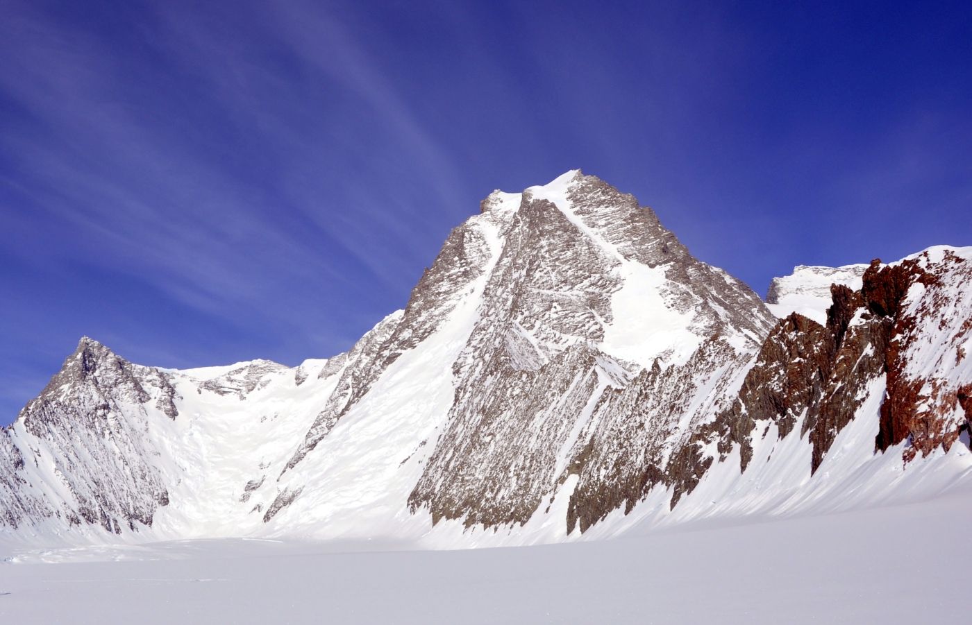
Located less than 13 kilometres (8 miles) northwest of Mount Vinson, Mount Tyree rises above the surrounding peaks in the Sentinel Range.
At 4,852 metres (15,919 feet) in elevation, Tyree is the second tallest peak on Antarctica and one of the more challenging of the Seven Second Summits to climb.
While Tyree is 40 metres (130 feet) shorter than Vinson, it is considered far more technically, physically and mentally difficult to climb. As a result, only an estimated two dozen people have made it to the mountain’s summit.
Challenges of climbing Mount Tyree
A combination of the physical and technical abilities required to climb Mount Tyree coupled with its extremely remote location makes it one of the most difficult to climb in Antarctica and the rest of the world.
Even the most straightforward route up the peak requires advanced glacier climbing and mixed rock and ice climbing once atop the glacier and on the summit ridge from a technical standpoint.
The route is steep and exposed, so climbers will need a high level of physical fitness to make the ascent. This comes after climbers heave hauled all their gear to the base camp from the starting point.
The remote location means that climbers must be self-sufficient and prepared to deal with whatever the mountain throws at them.
How to get to Mount Tyree
All expeditions to Mount Tyree begin with a flight into the international airport in Punta Arenas (PUQ), Chile. Most guides will opt to meet up in the city and charter a flight to Union Glacier in Antarctica. From here, climbers will transfer to the base camp at the foot of the mountain.
Routes to Mount Tyree
Three main routes lead up to the summit of Mount Tyree, but the French is the most commonly taken.
After flying to Patton Glacier, a few kilometres northeast of the mountain, climbers will ski or snowshoe to the base of the mountain and set up camp. From here, climbers ascend through a large couloir and arrive at the northeast ridge.
Many climbers opt to set up the high camp here before following the ridge to the summit. The ridge is the most technical part of the route and requires a high snow and rock climbing ability.
Quick facts:
- Continent: Antarctica
- Elevation: 4,852 m (15,919 ft)
- Duration: 3 weeks
- Climbing season: December to January
5| Greenland Icecap
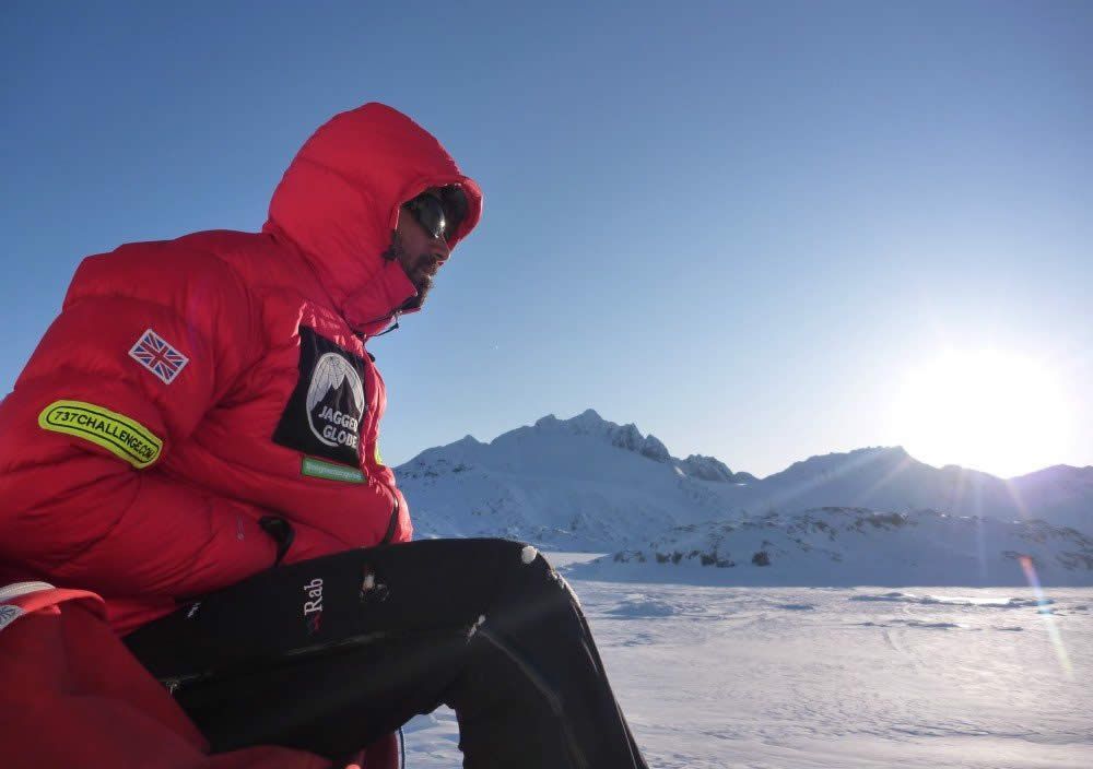
Sprawling over 1.7 million square kilometres (660,000 square miles), the Greenland Icecap covers roughly 80 per cent of the island’s landmass. The icecap is the second-largest ice sheet in the world after the one covering Antarctica.
Keep reading: 10 Incredible Mountaineering Destinations Around the World
The Greenland Icecap covers the center of the island and is surrounded by mountain ranges and fjords. The average elevation on the icecap is 2,135 metres (7,005 feet), with several mountains and high points on the ice cap reaching even higher elevations.
Due to its immense size and the pristine beauty of Greenland’s wilderness, traveling across the icecap on skis is a popular undertaking for intrepid ski tourers. Due to the unprecedented melting taking place, Greenland is becoming increasingly accessible to trekkers and mountaineers.
Challenges of traversing Greenland Icecap
Any type of expedition on to the Greenland Icecap brings with it plenty of challenges. The expedition to cross the icecap generally takes about one month and presents plenty of physical and logistical challenges.
In general, the skiing is not very technically challenging. The trickiest parts are usually climbing onto and off of the icecap. Otherwise, crossing the icecap only requires some previous off-piste experience.
However, the physical exertion required to cross the icecap is the most challenging part of any expedition. Skiers will need to be in excellent shape to haul their respective sled full of person and communal gear across the ice cap.
Stamina is of the utmost importance of this expedition as skiers will need to travel for eight to 10 hours per day with no rest days.
Away from the physical and technical requirements, plenty of planning is required to head across the icecap. Skiers will need to haul all of their own gear and be completely self-reliant as there is no infrastructure on the icecap, and help is usually far away.
How to get to the Greenland Icecap
Any trip to Greenland will begin with a flight into Iceland’s Reykjavik Airport (RKV) or Greenland’s Kangerlussuaq Airport (SFJ). Most guides will opt to meet at one of these points and arrange transport to Isortoq or another starting point.
Routes over the Greenland Icecap
There is no main route that leads across the Greenland Icecap, but many guides opt to follow the Arctic Circle at 66 degrees.
The expedition usually begins on the eastern coast of Greenland and heads west. Skiers will begin the expedition by climbing up onto the ice cap from the east shore, which is usually the most technically challenging part of the trip.
Once on the icecap, the route continues with a gradual 240 kilometre (150-mile) ascent to the high point of the glacier, at 2,500 metres (8,200 feet) above sea level.
Skiers will then begin the gradual descent of the western side of the icecap. After descending off the icecap at Point 660, the expedition finishes with a 40-kilometre (25-mile) trek to Kangerlussuaq fjord.
Quick facts:
- Location: Greenland
- Elevation: 2,500 m (8,202 ft)
- Duration: 4 to 5 weeks
- Ski touring season: April to June
6| Hardangervidda
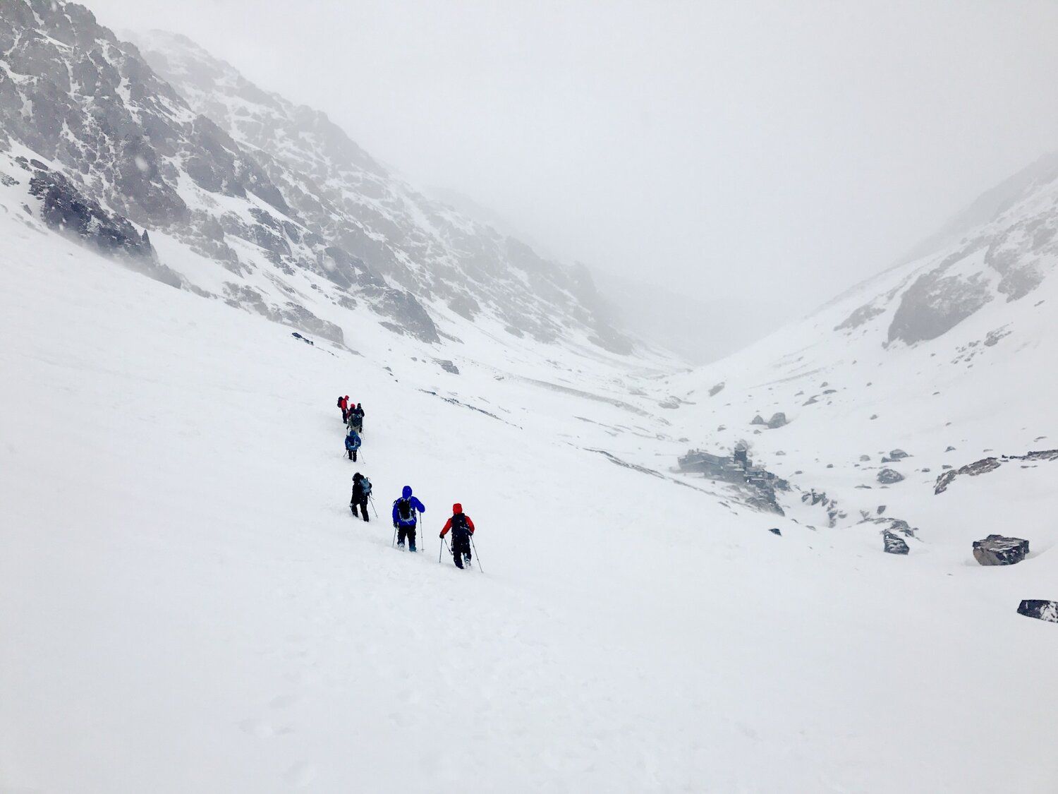
Situated about 180 kilometres (110 miles) west of Oslo, Hardangervidda is the largest national park in Norway.
Sprawling over 6,500 square kilometers (2,500 square miles) in the southwest of the Scandinavian country, the park is perched atop one of the largest plateaus in Europe.
With an average elevation of 1,100 metres (3,600 feet), the entire park is above the treeline, yielding incredible panoramic vistas over the barren moorland and some of Norway’s largest glaciers.
Due to its unique geography and immense natural beauty, Hardangervidda is one of the country’s most popular tourist destinations.
In the summer, the park offers plenty of excellent options for trekking and backpacking. Meanwhile, the park is transformed by the snow into a veritable playground for ski touring enthusiasts in the winter and early spring.
Challenges of ski touring in Hardangervidda
Due to its topography and elevation, any ski touring expedition to Hardangervidda comes with plenty of challenges.
Most expeditions to cross the plateau are relatively flat but will require some ascents and descents. As a result, participants should be comfortable skiing off-piste and preferably in nonideal weather conditions.
Due to its elevation and location, Hardangervidda is entirely exposed. Storms are not uncommon and can lead to whiteout conditions. Ski tourers need to be prepared to deal with these conditions.
Away from the technical and climatic challenges, crossing the Hardangervidda plateau is a physical challenge.
Most expeditions to cross the plateau take slightly more than a week. During this time, ski tourers will travel between six and eight hours each day while hauling a sled that may weigh as much as 25 kilometres (55 lbs). As a result, being in shape is highly important.
How to get to Hardangervidda
Most trips to Hardangervidda begin with a flight into Oslo Gardermoen Airport (OSL). Many guides will opt to meet here before taking the train to Finse and heading right out onto the glacier.
Routes across Hardangervidda
There is no single route for ski tourers to take when exploring Hardangervidda. However, there are a few popular options available to choose from.
Among these is heading to Finse and spending 10 days crossing the 100-kilometre (60-mile) distance from one side of the park to the other. Most guides opt to start from Finse instead of Rjukan as the latter is located at a much lower elevation. The trip is fairly uniform from here, with participants spending the day skiing before setting up camp at night.
Many guides offer shorter excursions for individuals who want to explore the national park but do not have an entire week available to do so. These generally begin from Finse and travel in a loop through the north of the park, with the duration depending on time allowances.
Quick facts:
- Location: Norway
- Elevation: 1,100 m (3,600 ft)
- Duration: 2 days to 2 weeks
- Ski Touring Season: February to April
7| Finnmarksvidda
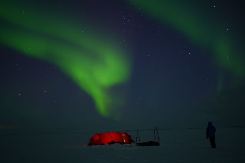
Located in the northernmost reaches of continental Norway, Finnmarksvidda is the country’s largest plateau and one of its most remote ski touring destinations.
Sprawling over 22,000 square kilometres (8,500 square miles), an area roughly the size of Belize, the plateau comprises glacially carved lakes, bogs and thick forests of birch and pine.
With an average elevation between 300 metres (980 feet) and 500 metres (1,640 feet), there are also plenty of incredible views to take in across the plateau.
Part of the attraction for many ski tourers headed to Finnmarksvidda is its remote location. It takes about three flights to arrive at the plateau, meaning it remains one of the world’s most pristine and virgin landscapes to explore.
Challenges of ski touring Finnmarksvidda
Any expedition to the northernmost reaches of Norway comes with a variety of different types of challenges.
During the winter, plenty of snow falls on Finnmarksvidda, meaning participants must be competent off-piste skiers and capable of handling a variety of different snow textures.
However, this is not the most difficult part of the trip. The combination of withstanding the elements and the physical challenge of touring the plateau is much tougher.
As with any polar expedition, ski tourers must be prepared for high winds, low temperatures and long nights (though no polar bears generally at latitude). With no infrastructure on the plateau, expeditions must also be completely self-reliant.
Away from the climate and technical challenges, any expedition across Finnmarksvidda is also incredibly physically taxing. Ski touters must be prepared to travel for six to eight hours each day, hauling a sled with all the gear along the way. After traveling all day, participants will need enough energy to help set up camp, cook, and clean.
How to get to Finnmarksvidda
Any trip to Finnmarksvidda begins with a flight into Oslo Gardermoen Airport (OSL). Most guides opt to meet here before transferring to Tromsø Airport (TOS) and then Alta Airport (ALF). From here, skiers and the guide will make the short drive to the start of the trip.
Routes through Finnmarksvidda
While there is no single defined route for ski tourers headed across Finnmarksvidda, there are a few highlights that guides opt to visit and tailor their expeditions around.
Many opt to begin trips from Jotka Lodge and cross the plateau to Karasjok. Both locations offer a bit of luxury after a long 10 days out in the arctic.
However, at the start of an expedition, ski tourers will first cross Lake Lesjavri before ascending onto the plateau. From here, skiers will head between 15 and 20 kilometres (9 to 12 miles) each day, passing over lakes and through forests until arriving at the road that leads to Karasjok.
Quick facts:
- Location: Norway
- Elevation: 300 m (980 ft) and 500 m (1,640 ft)
- Duration: 1 week to 10 days
- Ski touring season: March to May
8| Svalbard
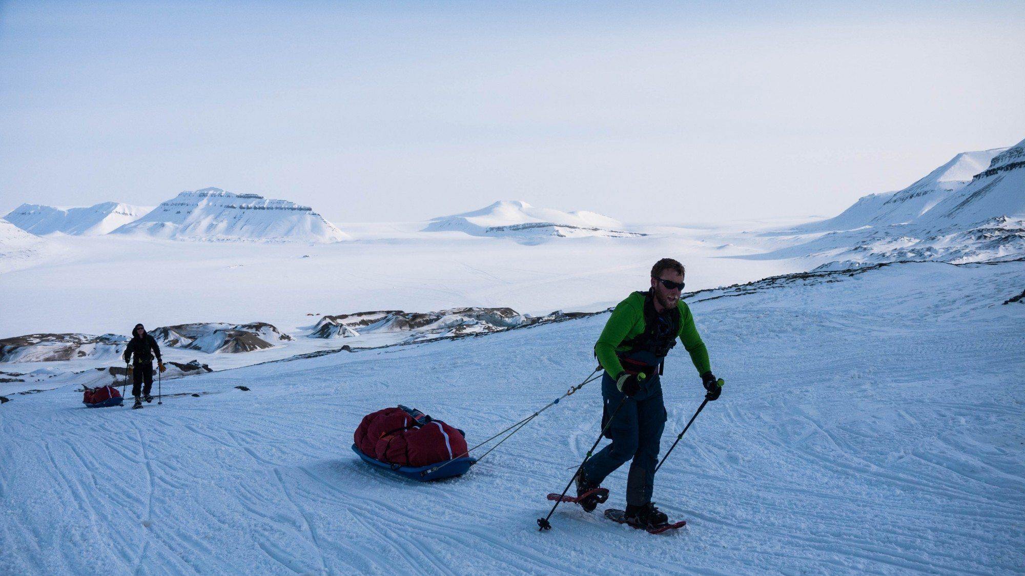
Composed of mountains, fjords, glaciers and valleys, Svalbard is a remote archipelago located halfway between Norway and the North Pole.
Composed of three main islands – Spitsbergen, Nordaustlandet and Edgeøya – and several smaller ones, Svalbard is an increasingly popular destination for intrepid ski tourers seeking out the ultimate polar adventure.
Keep reading: Top 10 European Trekking and Mountaineering Destinations
With the second-lowest population density of any country or dependent territory (Greenland has the lowest), Svalbard offers plenty of unspoiled nature for ski tourers to explore.
Many ski touring expeditions opt to stick to the main island, Spitsbergen, which has the largest settlement in the archipelago. Many skiers opt to head east from here, skiing from the tops of the coastal mountains down to the ocean.
Challenges of skiing on Svalbard
Due to its unique location close to the North Pole, ski touring on Svalbard brings a specific set of challenges.
From a technical standpoint, skiing is quite tough. Participants will need to climb in skins before skiing back down to the coast over various snow types at sometimes quite steep angles.
Along with the technical difficulty, ski tourers also must be in excellent physical condition. Most ski touring expeditions on Svalbard involve eight hours of climbing and skiing each day, occasionally pulling a 30 kilogram () sled of gear.
Away from the physical and technical challenges of ski touring on Svalbard, there are also natural ones. Along with the climate, there is also the risk of running into a polar bear, which means skiers must be vigilant and aware of any polar bear tracks or droppings.
How to get to Svalbard
Almost all trips to Svalbard begin with a flight into Svalbard Airport (LYR), which can be reached directly from Oslo and Tromsø. Most guides will opt to meet at the airport or elsewhere in Longyearbyen, the archipelago’s main settlement. From here, guides will provide transport to the start of the trip.
Popular destinations for skiing Svalbard
Home to seven separate national parks, tens of thousands of square kilometres of landmass and thousands of kilometres of coast, Svalbard boasts plenty of popular ski touring spots.
Chief among these is Nordvest-Spitsbergen National Park, located in the northeast of the main island. Home to some of Svalbard’s most iconic scenery, as well as its tallest mountains, the park serves as a veritable playground for ski touring enthusiasts.
Many guides offer trips ranging from less than one week to more than two weeks. The trips usually involve heading out in a loop through the park, skiing up and down some of the archipelago’s highest peaks en route.
Quick facts:
- Location: Norway
- Elevation: 1,717 m (5,633 ft)
- Duration: 1 to 2 weeks
- Ski touring season: March to May
Begin planning your next polar adventure
Whether you plan to head to the top or bottom of the world, it will take some planning. Begin the process by comparing trips and reading certified reviews of qualified guides on ExpedReview!